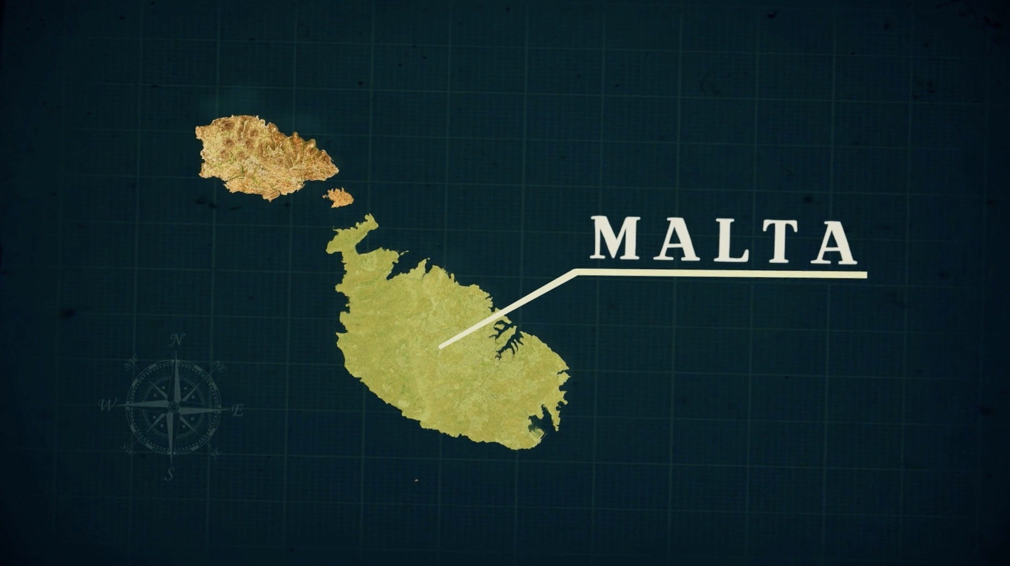
Malta (ancient Melite, Latin Melite Africana), part of a small archipelago in the Mediterranean Sea about 58 miles south of Sicily, is an island about 17 miles long and 9 miles wide. Malta is the largest of the three main islands in the archipelago, Malta, Gozo, and Comino, all known from antiquity, plus several small islands and rocks (Diodorus Siculus, Library of History; Strabo, Geography). People have lived on the island for thousands of years, as evidenced by a culture which erected large stone temples and carved stone reliefs with intricate designs. Around the 8th century BC, the Phoenicians settled on the island and brought technology such as metallurgy and writing (Ashby and Rushforth, “Roman Malta”). The ancient name for the island is derived from Phoenician Melita, which means “refuge,” and has continued in use to the present day. By about the 6th century BC, Malta had come under the control of the Phoenicians from Carthage. However, due to the spread of Hellenism around the Mediterranean and Malta’s proximity to Sicily and the Aegean region, Greek influence was found alongside Phoenician, evidenced by discoveries such as an inscription to the god Melqart/Herakles written in both Phoenician and Greek (Ashby and Rushforth, “Roman Malta”; IG xiv, 600). Then, in 218 BC during the Second Punic War, Malta surrendered to the Romans under Sempronius Longus, and Malta became part of the Roman province of Sicily (Livy, History of Rome). The situation seems to have been one in which the native inhabitants submitted to Roman rule peacefully and voluntarily, perhaps resulting in a favored status which gave Malta more freedom (Ashby and Rushforth, “Roman Malta”). After the islands fell under the leadership of the Romans, the name of the main city switched from Maleth to Melite, which is the ancient derivation of the modern name Malta. The island was apparently fertile, and cotton was a major product, along with olives (Strabo, Geography; Ovid). Each of the two major islands, Malta and Gaulus/Gozo, had a preeminent town in which an official or officials lived and ruled. Eventually, Malta and the other islands became municipalities with Roman officials of duumvir and Decurion rank, but until the 2nd century AD it seems that local rulers were utilized.
Although information about Malta in the Roman period is limited, a few references to it in ancient works are preserved, and recent archaeology has revealed aspects of life on the island. In Roman times on Malta, there was at least a temple of Melqart, a temple of Juno/Hera (possibly Astarte in earlier times), a temple of Proserpina (Roman goddess similar to Persephone, temple renovated during reign of Augustus), possibly temples of Artemis (a statue of Artemis discovered near the harbor) and Apollo (indicated by an inscription and a platform discovered under Villegaignon Street), Emperor worship on the island, and an ancient temple to Baal-Hammon which probably fell out of use after the Carthaginian period (Cicero, Verres; Valerius Maximus, Memorable Deeds and Sayings; Ptolemy; Ashby and Rushforth, “Roman Malta”; CIL X 7494). The people seem to have combined aspects of Roman, Hellenistic, and Phoenician religion as was common in areas of the Empire where the Phoenicians had lived. Malta had multiple harbors used in the Roman period, including one called Marsa directly east of the main town of Melite, which had a temple of Juno above it. This was located around the present Grand Harbor by Fort Sant Angelo. Among the discoveries in the harbor area were large storage facilities, cisterns, amphorae, Greek inscriptions, and a cross carved into the wall (Ashby and Rushforth, “Roman Malta”). The inscriptions and the cross, however, were probably from the Byzantine period. It was here that Roman ships must have spent the winter when docked at Malta (Acts 28:11). Remains of Roman baths were found, and architectural fragments appearing to be from a theater were also discovered on the island (theater near temple of Apollo). The ancient city itself was located farther inland, on a flat ridge near the center of the island, rather than on the coast. Outside of the main city, near modern Rabat, a Roman villa (Domus Romana) from the 1st century BC to 2nd century AD was discovered, including statues of Emperor Claudius and his daughter Antonia, and impressive mosaics. Among the mosaic floors found in the house was one containing a scene which seems to depict Samson and Delilah (Ashby and Rushforth, “Roman Malta”). According to finds in one of the ancient cemeteries on Malta, including a menorah inscription, it seems that there were some Jews living on the island in the Roman period, probably from the 2nd to the 5th century AD, which could also account for the presence of the “Samson and Delilah” mosaic if it is not due to Christianity. Alternatively, scholars have suggested that it may be a scene from pagan mythology that looks similar to Samson and Delilah.
It was on this small island that Paul, while sailing to Rome, probably in late October of 59 AD, was shipwrecked along with 275 others after being pushed off course by storms in the Adriatic Sea for 14 days (Acts 27:14-28:1). In antiquity, sailors named four major winds, which could be used in various combinations to describe 12 directional winds (Seneca, Natural Questions; Keener, Acts). On their way from Crete to Syracuse, the ship was caught in a wind called Euraquilo (Eurus plus Aquilo), which was an east northeast wind, blowing them off course from that direction and forcing the ship southwest of their next destination (Acts 27:14-15). Passing south of the small island of Clauda (Cauda, modern Gaudos), which is west of Crete, the crew was able to save the skiff and bring it onto the ship (Acts 27:16; Keener, Acts). Wanting to avoid the Syrtis at all costs, which was a large area of shallow sandy gulfs notoriously dangerous for sailors, the crew let down an anchor to stop them from going farther south (Strabo, Geography; Dio Chrysostom, Orations; Franz, “Why Were the Sailors Afraid of the Syrtis Sands?”). Due to the many boats that had been caught and wrecked in the area of the Syrtis, the place was greatly feared by sailors in antiquity and associated with mythological monsters (Keener, Acts). After 14 days of being tossed about in the sea, the sailors perceived that the ship was approaching land, which fits the estimated time of a boat drifting under storm conditions from Clauda to Malta more than 470 nautical miles (Keener, Acts). Wanting to confirm land, they dropped sounding leads and discovered that the depth was 20 fathoms, then 15 fathoms as they continued to approach (Acts 27:28; Hemer, The Book of Acts; Ptolemy; Pliny the Elder). According to a nautical analysis, a ship drifting from the island of Clauda would pass Point Koura where the breakers would serve warning, and nautical charts show that after passing this point the ship would be in water 20 fathoms and then 15 fathoms deep on a west by north course (Ramsay, St. Paul the Traveller; Smith, The Voyage and Shipwreck of St. Paul). Knowing that they might run aground if the ship continued to be driven towards the land, the sailors threw 4 anchors to stop the ship until morning, which was a practice of ships attempting to thwart a wreck even during the Roman period. When dawn came and the land could be seen, none of the sailors recognized the place, but they decided to drive the ship onto the beach. Casting off the anchors and raising the foresail so that the ship might be beached, the ship headed for the shore, but struck a “place where two seas met” which was probably a reef, underwater rocks, or a large sandbar. Abandoning ship, the soldiers, sailors, and prisoners all swam to shore before the ship was torn apart by the waves. Only about 2 years earlier, Josephus had a similar experience of being shipwrecked on the Adriatic Sea while on his way to Rome, swimming all night until a ship from Cyrene rescued them (Josephus, Life). The shipwreck that Josephus experienced may have occurred due the to Syrtis, which the sailors with Paul were desperately trying to avoid.
The site of the shipwreck, according to an old tradition on the island, is usually placed at St. Paul’s Bay on the northern shore of the island, about 13 km northwest of modern Valletta. Although the antiquity of the tradition is difficult to trace, the description of a place where “two seas met” and a bay with a beach does appear to match the geography of St. Paul’s Bay with a channel of water between the island of Salmonetta and the bay on the island of Malta (Acts 27:39-41; Smith, The Voyage and Shipwreck of St. Paul). Various geographical and historical clues are given in the account in Acts which allow a tentative identification of the site of the shipwreck. The island is called Malta (Melite) and on the Adriatic Sea. Although the Greek name “Melite” (Malta) was used for two islands and is also similar to the name of a location on another island, the alterative island, in antiquity called Melita Illyricum, is just off of the coast of modern day Croatia (Dalmatia) near Dubrovnik, and does not fit the route or wind described in Acts, nor the route of Alexandrian grain freighters in the Roman period. Thus, the island of Malta is considered the Melite referred to in Acts, not the island of Meleda/Mljet (Melita Illyricum) of Dalmatia or Mitylene on Lesbos (Acts 28:1; Acts of Peter and Paul). The specific wreck site was described as land unrecognizable to the professional sailors, suggesting that it was not a location that the ships normally passed by on their way to Rome, a bay with a beach which had beyond the shore a feature like a reef, sandbar, or rock outcrop, and a place “where two seas met” (Acts 27:39-42). The criteria fit St. Paul’s Bay, although other possibilities on the island exist. In front of the beach at St. Paul’s Bay is a shoal where the ship could have struck and became stuck in a place where the waves are fierce and would have battered the ship (Keener, Acts). Further, if approaching the eastern coast of Malta and the area of the main Roman harbor, the sailors would have been able to see the temple of Juno and other landmarks, but they did not recognize the land and no buildings were noted, which suggests the possibility of a shipwreck on the northern part of the island (Acts 27:39). The account of Lucian which describes the route of grain freighters from Alexandria to Rome in 150 AD places the normal route past Malta on the eastern side, where the main harbor and various structures such as the temple were visible, indicating why the sailors would not have recognized a bay on the north side of the island (Lucian, The Ship, or The Wishes). This ship, the Isis, at about 180 feet long and around 1,000 to 1,300 tons with 3 masts, was probably larger than the vessel that Paul sailed on, but both were grain freighters with considerable storage capacity. Josephus sailed on a similar freighter, which was transporting 600 people (Josephus, Life). The discrepancy between the amount of people on the ships in Acts and Josephus, 276 versus 600, is thought to be because Paul was traveling in the winter when fewer people attempted the journey due to the danger of storms (Casson, Ships). These remarkably large ships, which carried vast amounts of cargo and hundreds of passengers, were not exceeded in size in the modern period until the beginning of the 19th century. Therefore, according to the itinerary of the ship Isis documented by Lucian and the account of Acts, the probable route of the grain ship which Paul sailed on would have been from Alexandria to the west of Cyprus to Myra where Paul boarded, to Rhodes to Fair Havens on south Crete, then blown off course to the north side of Malta rather than the typical route on the east of the island. The trip was meant to conclude with stops at Syracuse, Rhegium, and either conclude at Puteoli or go on to Ostia, the harbor town of Rome. The site of St. Paul’s Bay also had a variety of archaeological material, including Roman period structures on land and Roman anchors on the seabed, indicating that the area was inhabited during Roman times and that ships had been in the bay (Ashby and Rushforth, “Roman Malta”). Other locations for the shipwreck on Malta have also been suggested based on geographical analysis and the discovery of anchors, although they lack the ancient tradition and do not appear to match the geography and archaeology as well as the site of St. Paul’s Bay (Keener, Acts; Witherington, The Acts of the Apostles; Franz, “Does the Lost Shipwreck of Paul Hold Water?”; Cornuke, The Lost Shipwreck of Paul; Harris, “Malta”). A recent alternative suggestion for the shipwreck site is at the Munxar Reef in Marsaskala, near St. Thomas’ Bay on the eastern coast of Malta (Cornuke, The Lost Shipwreck of Paul). At least one Roman period anchor from a large freighter such as an Alexandrian grain ship has been found in this area, although similar anchors have also been found in the sea around various parts of the island. The anchors, which have been discovered in bays around Malta, can at least be an illustration of what the anchors on Paul’s ship would have looked like. The main problem with the Munxar site, in contrast to St. Paul’s Bay, seems to be that the sailors would have recognized the land because there was a temple to Juno near the shore, and that part of the island was the normal turning point on the route to go north towards Rome.
After Paul and the others made it safely ashore, they discovered that the name of the island was Malta, probably after meeting some of the local residents (Acts 28:1-2). These locals were described by Luke as “barbaroi,” meaning they were not speaking Greek or Latin. Coins found on Malta dating up to the time of the Roman takeover in 218 BC show that the Punic language and Phoenician script were common, and inscriptions discovered on Malta, including bilingual texts, demonstrate that Punic or Phoenician was used alongside Greek and Latin even in the 1st century AD as the local language which was still in use by natives of the island (Witherington, The Acts of the Apostles). In fact, the bilingual inscriptions found on Malta led to the decipherment of the Phoenician alphabet in the 18th century (Jean-Jacques Barthélemy). Since these people spoke the Punic dialect, descended from Phoenician, which was extremely close to ancient Hebrew, Paul would have been able to carry on a conversation with them even without using Greek or Latin (McRay, Paul; Krause, “Malta”).
While sitting around the fire after the shipwreck, Paul was bitten by a snake (“viper”), which the locals perceived as poisonous and as a consequence of divine judgement (Acts 28:4; cf. Mark 16:18). Although it is often claimed that Malta no longer has any species of snake which is venomous out of its four still present on the island, one or more species may have gone extinct after nearly 2000 years on the small island with continuous human habitation. Alternatively, the snake mentioned has been suggested as a constrictor snake which looks similar to a poisonous viper (Coronella austriaca) and attaches itself to its prey, and therefore it could have been perceived as poisonous, since in the ancient world most snakes were thought to be poisonous (Hemer, The Book of Acts; Pliny, Natural History). However, one of the four snake species on Malta, the Cat Snake or Soosan Snake (Telescopus fallax), is actually venomous, and its habitat includes beaches and open woodlands. Its fangs are located at the back of the upper jaw rather than the front, it rarely injects its venom in defensive biting, and apparently it would not cause severe harm to humans. Whatever species of snake it was that bit Paul on the hand, the inhabitants of Malta would probably have known that this snake could inject venom into its victim, and therefore, it was specified as a “viper” by Luke. Initially believing that Paul was being punished, the locals probably referred to a goddess that was worshipped on Malta as “Justice” (Acts 28:4). “Dike” was the Greek goddess of justice, a daughter of Zeus who kept watch on the earth and reported injustices to Zeus (cf. Hesiod, Work and Days; Plutarch, Moral). This goddess “Justice” (Dike) also had a Phoenician equivalent named Sydyk, and in the narration Luke probably used the Greek translation of what the locals said (Witherington, Acts of the Apostles; Philo of Byblos).
After warming themselves around the fire, Paul and his group were welcomed for three days at a nearby estate of a man named Publius (Poplius is the Greek equivalent of the Latin name Publius) who Luke recorded as “the first man of the island” (Acts 28:7). This “first man of the island” appears to be a political title used on Malta in the 1st century AD, as a Greek inscription found from the reign of Tiberius mentions L. Castricus Prudens, a man of equestrian rank who was “the first of the Maltese” and “father,” probably holding the same title and position as Publius did around 30 years later when Paul was on the island in about 59 AD (CIG, 14. 601; IGRR 1.512/IG 14.601). The Romans had set up a local magistrate over the island, designated with the Latin title municipi Melitesium primus omnium (“the first over all in the municipality of Malta”) according to a 1st or 2nd century AD inscription (CIL 10.7495; cf. CIG 5754 and ILS 5415). This appears to be the Latin equivalent of the Greek “first of the Maltese” found in Acts and the Prudens inscription. Serving under the governor of Sicily, the Roman province of which Malta was part of at that time, Publius would have been the local leader of the island. Publius was a common praenomen (personal name) for Romans, used in circumstances of familiarity which Luke employs often for the names of Christians in Acts, and this was probably the reason why Luke used his praenomen rather than the more formal cognomen (FF Bruce, The Book of Acts). The estate of Publius would have been a Roman type villa, belonging to a wealthy local man who apparently held a position of political prominence on the island. His family lived on the island with him, including his father who Paul prayed for and healed of a fever and dysentery (Acts 28:8). This ailment may have been a long term acute bacillary dysentery with fever, perhaps “Malta fever” (Micrococcus melitensis), as a result of consuming infected food or water (Keener, Acts). Near Rabat, the cave called St. Paul’s Grotto where a tradition claims that Paul lived during his three months on Malta has been venerated since 1366 AD, and therefore appears to have no actual connection to Paul (Freller, “Pauline Cult”). The church of St. Paul Milkghi, not far from St. Paul’s Bay, supposedly marks the location of the house of Publius according to tradition. Excavations did discover that a Roman villa was present on the site of the church, making the identification at least possible if not plausible (Ashby and Rushforth, “Roman Malta”). Although many people on Malta who had diseases came to Paul to be cured over the course of the three months on the island, and the locals gave them supplies and honored them, oddly Luke does not specifically record any Gospel preaching or conversions on Malta (Acts 28:9-10). However, inscriptions and artwork in catacombs from the 3rd century and later, in addition to a 4th century church father from Antioch, suggest that some of the people on Malta may have become Christians as a result of Paul’s visit (John Chrysostom, Homilies on Acts; Ashby and Rushforth, “Roman Malta”; Keener, Acts). Church history also states that a man named Publius, perhaps the same person as the one Paul met on Malta, became the bishop of Athens and was later martyred, possibly during the reign of Trajan around 112 AD (Jerome, Lives of Illustrious Men; cf. Pliny, Letter to Trajan). At the end of 3 months, which was probably February and the beginning of the sailing season, weather permitting, Paul and his group were taken aboard another Alexandrian grain ship headed for Italy, and the journey to Rome resumed (Acts 28:11; Pliny, Natural History). According to a Byzantine and Medieval period work, a church of the adjacent island of Gozo, part of the Maltese archipelago, received a donation from Constantine, demonstrating the presence of Christianity in the island group prior to the legalization of Christianity in 313 AD (Liber Pontificalis).


Dr. Titus Kennedy is a field archaeologist working primarily with sites and materials related to the Bible. He works with ColdWater Media and Drive Thru History® to maintain historical accuracy throughout their scripts and locations. Many of the archaeology blog posts are based on his publications, including Unearthing the Bible, Excavating the Evidence for Jesus, and The Essential Archaeological Guide to Bible Lands.

Leave a Reply